Lower San Joaquin River Flood Control Project
Facilities.
- Project was designed and constructed by California Department of Water Resources.
- Construction began in 1959 and concluded in 1967 (a total of 16 contracts).
- Designed for 50-year flood frequency protection.
- 191.4 miles of project levees and the channels they protect.
- 108 miles of river channel incorporated into project.
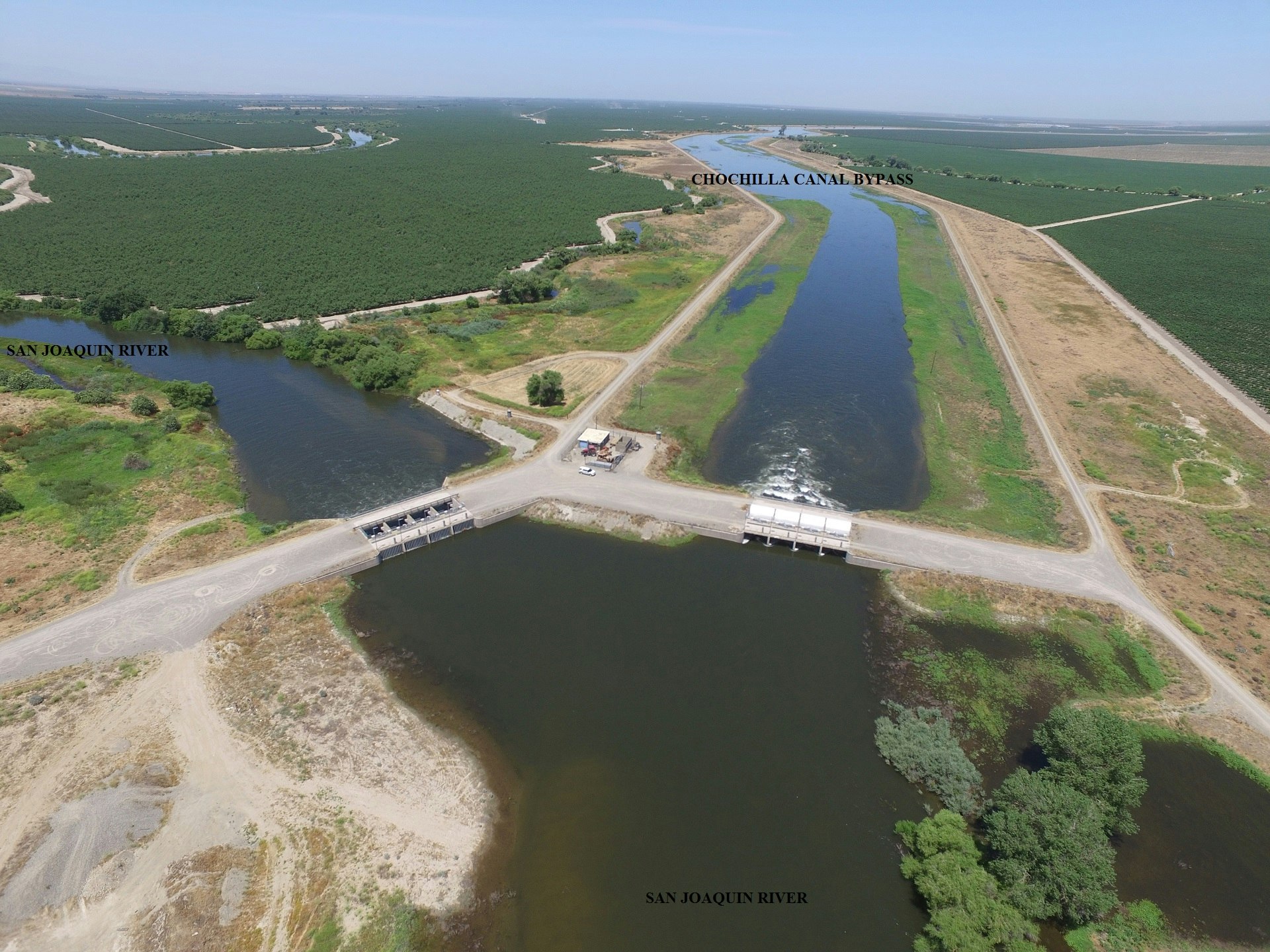
Control structures.
- Chowchilla Canal Bypass (four bays - all with automated radial gates).
- San Joaquin River (four bays - all with automated radial gates).
- Mariposa Bypass (14 bays - eight with automated radial gates).
- Eastside Bypass (six bays - all with automated radial gates).
- San Joaquin River Structure (four 6 'x 5' culverts with manual slide gates).
Other structures.
- Ash Slough drop structures (four - erosion control).
- Chowchilla Canal Bypass drop structures (two - erosion control).
- Drain pipes with flapgates through levees (328 count for local drainage into system).
Channel rated capacities.
- San Joaquin River is rated at multiple channel capacities with 3-foot freeboard design.
- Bypass channels are rated at multiple channel capacities with 4-foot freeboard design.