
Maps
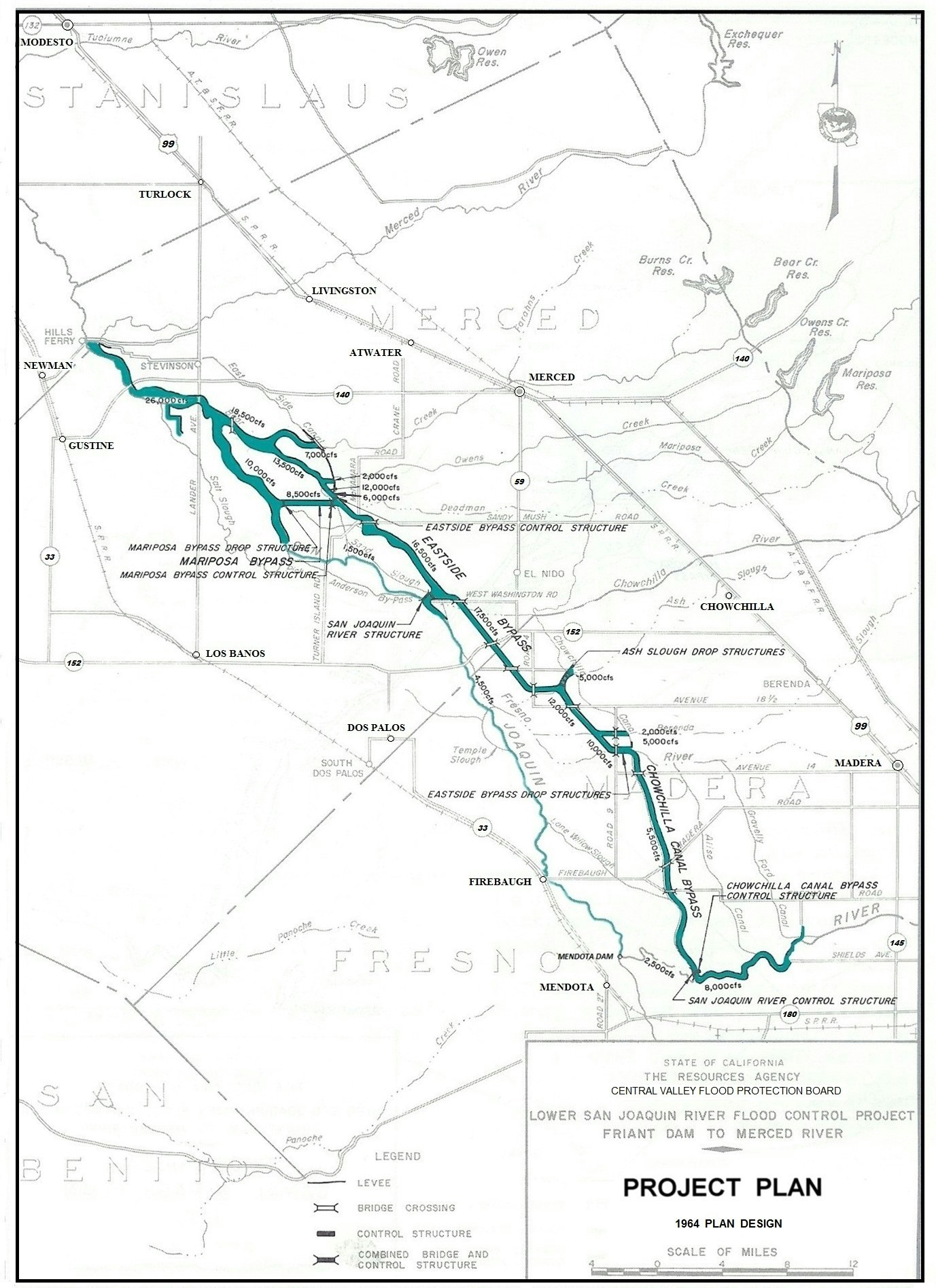
LOWER SAN JOAQUIN RIVER FLOOD CONTROL PROJECT - Project Plan 1964 Design The project was designed and constructed by the State Department of Water Resources between 1959 and 1967, through the issuance of 16 separate contracts. The project's purpose is to provide 50-year flood frequency protection along the San Joaquin River and tributaries in Merced, Madera, and Fresno Counties. The plan covers 108 river miles, contains 191.5 miles of levees with multiple control structures, and a series of bypasses (61 miles of channels). The project was built to collect flood flows from the San Joaquin River system, Kings River system, Fresno River, Chowchilla River, and the Merced County Streams Group. The bypasses divert flows around stretches of the San Joaquin where constrictions impair its capacity.
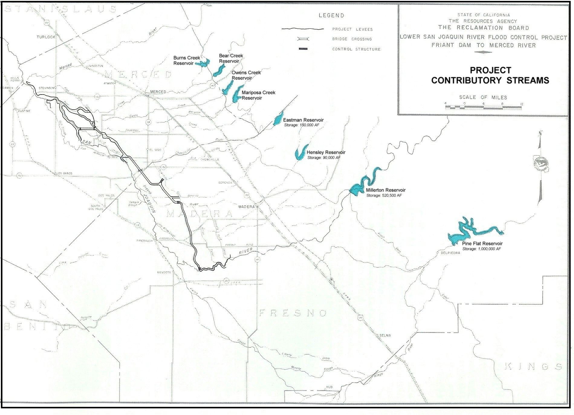
LOWER SAN JOAQUIN RIVER FLOOD CONTROL PROJECT - Project Contributory Streams
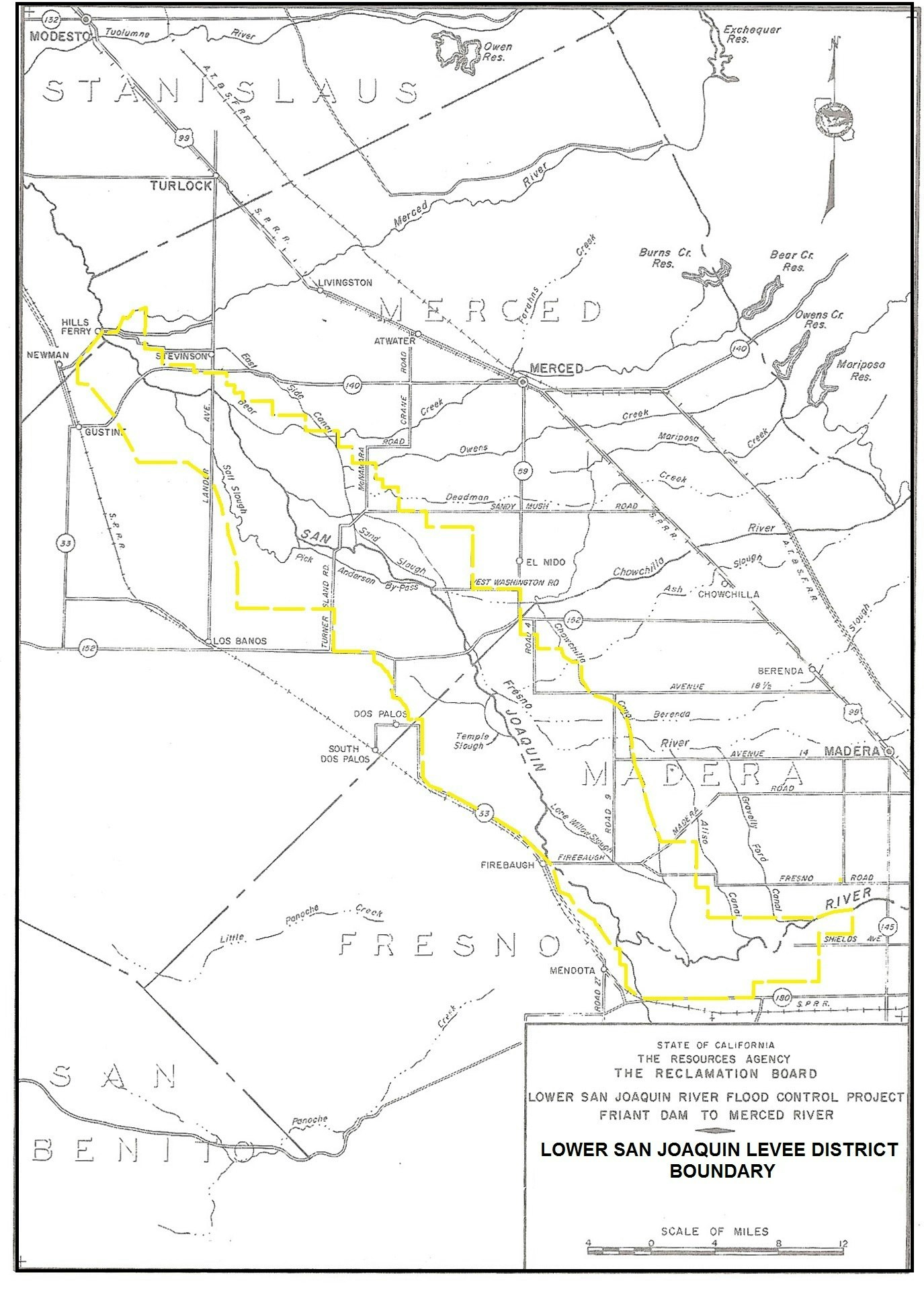
LOWER SAN JOAQUIN LEVEE DISTRICT - Boundary The Levee District boundary, which encompasses over 300,000 acres, was based on historical data as to areas subject to actual flooding and/or receiving benefit from the project, related to the designed capacity of the bypass system. The boundary was established along existing section lines, roads, canals, drains or other permanent lines that were reasonably close to the probable flood plain. The boundary description is incorporated into the legislative authorization for the Levee District.
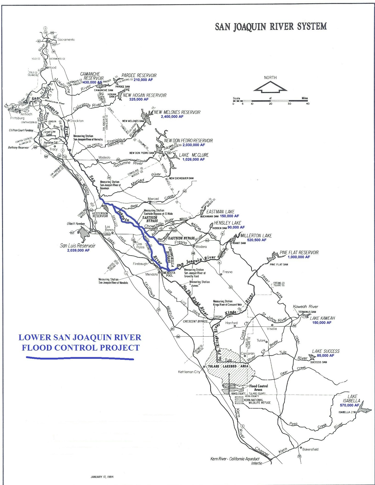
LOWER SAN JOAQUIN RIVER FLOOD CONTROL PROJECT - San Joaquin River System
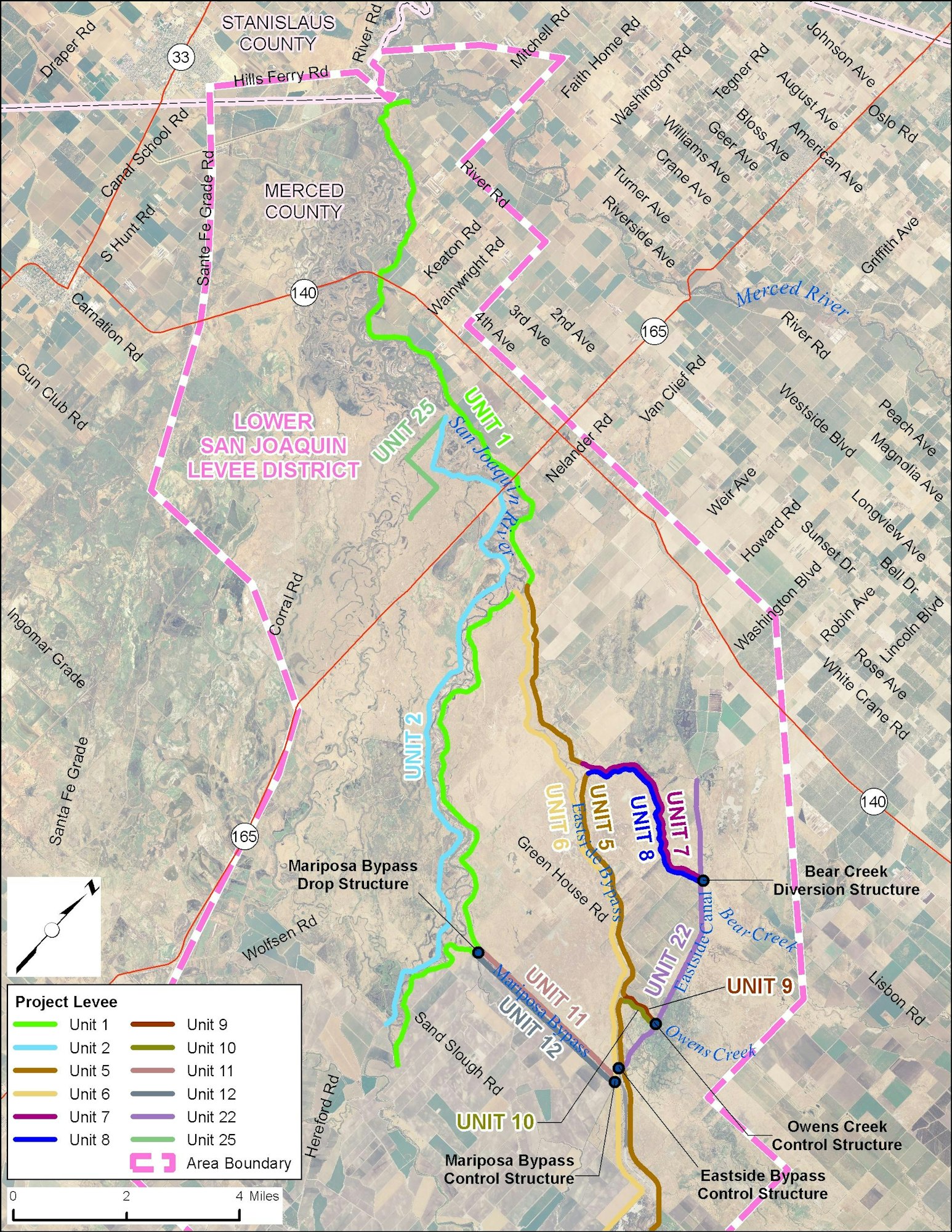
LOWER SAN JOAQUIN RIVER FLOOD CONTROL PROJECT - Levee Units & Structures (page 1)
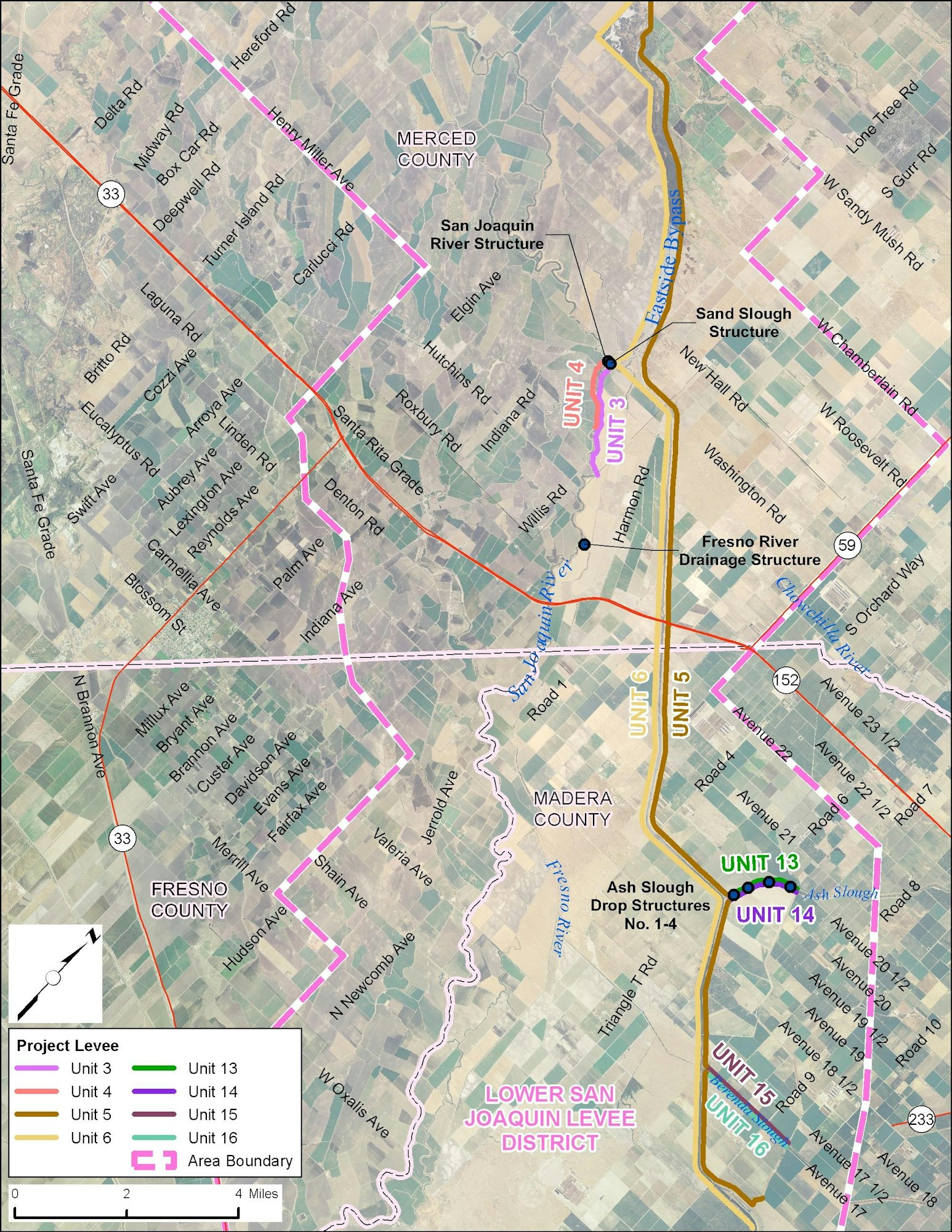
LOWER SAN JOAQUIN RIVER FLOOD CONTROL PROJECT - Levee Units & Structures (page 2)
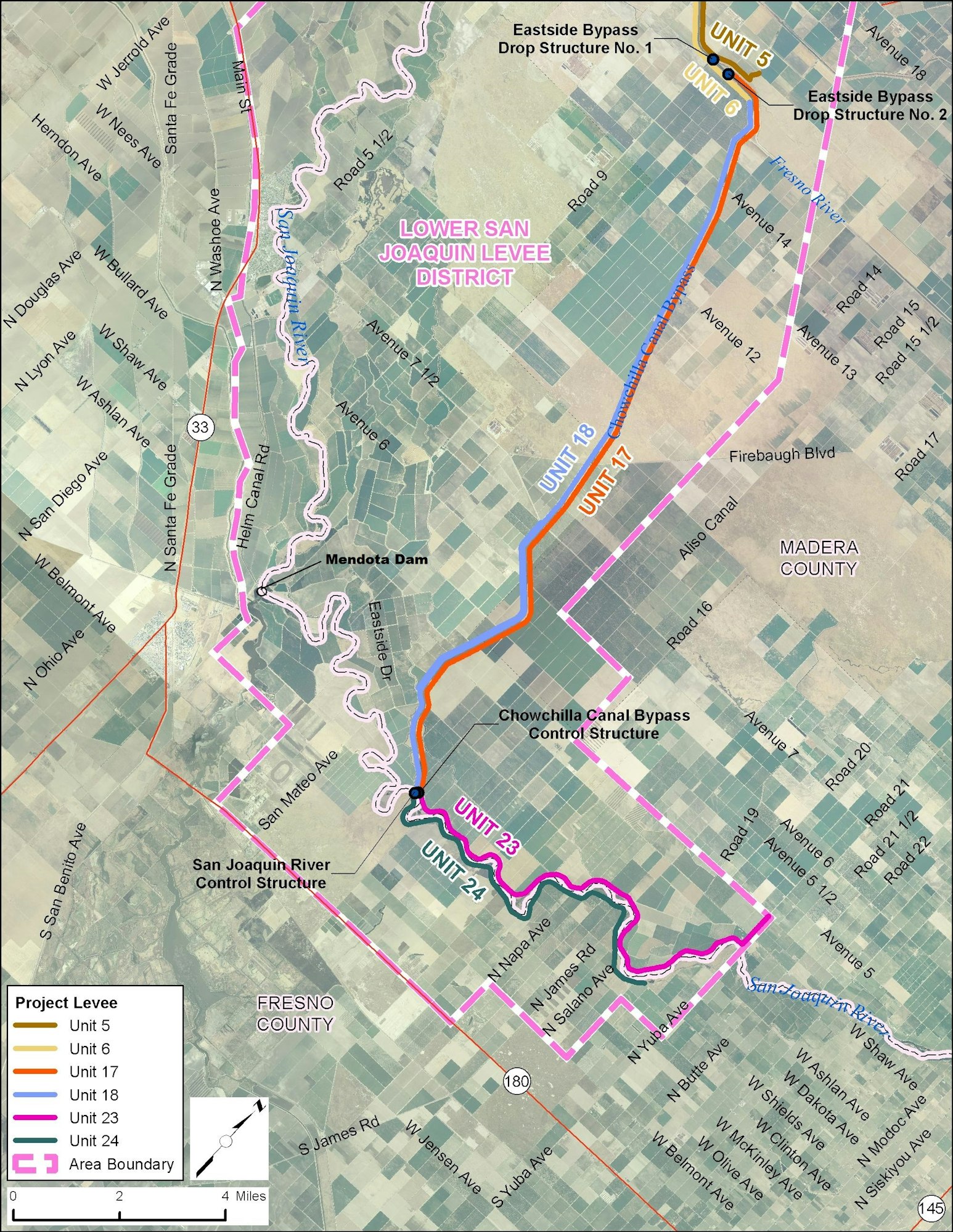
LOWER SAN JOAQUIN RIVER FLOOD CONTROL PROJECT - Levee Units & Structures (page 3)